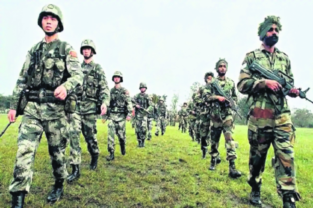
India's relations with China and Nepal deteriorated recently following the aggressive stand taken by the both the countries on the disputed borders. The Indian Army has taken “requisite countermeasures” by further bolstering troop reinforcements in eastern Ladakh in face of China’s continuing aggressive behaviour in four to five high-altitude locations along the unresolved border.
A few additional infantry battalions have been moved into Ladakh from other areas to ensure they can replace in “rear locations” the acclimatised troops shifted forward to the sites of confrontation with the People’s Liberation Army (PLA), said sources. Some other units under the Leh-based infantry division (a division has 10,000-12,000 soldiers) have also similarly moved to “occupy their forward operational alert areas” from their “permanent locations in depth” to cater for any contingency.
The serious nature of the escalation can be gauged from the fact that Army chief General M M Naravane himself visited Ladakh to take stock of the ground situation. But military and diplomatic lines of communication are also being kept open with China in a bid to de-escalate the almost month-long troop confrontations on the northern bank of Pangong Tso (Tso means lake), Demchok and Galwan Valley areas. “The military deadlock, however, persists till now,” said a source.
PLA more aggressive after India created UT of Ladakh
There have, in fact, been a few more scuffles between rival patrols since the major violent clash on the northern bank of Pangong Tso sector left several soldiers from both sides badly injured on May 5-6. The Army, on its part, continues to remain tightlipped about what has become the most serious confrontation since the 73-day face-off at Doklam near the Sikkim-Bhutan-Tibet tri-junction in June-August 2017.
The stand-off at Galwan Valley, a flashpoint even during the 1962 war, has become particularly tense with an estimated 1,200 PLA soldiers pitching 80 to100 tents and setting up other fortifications like bunkers in three to four positions in “patrolling point 14” and Gogra post areas, which are ahead of China’s “claim lines” in the region.
Indian positions in the area, around 500 metres away, have also been reinforced to “match” the opposing forces, said sources. Though there have been similar incursions by the Chinese troops in the past – like the 21-day face-off in Depsang Bulge area of the Daulat Beg Oldie sector in April-May 2013 - the much larger PLA presence, with its more aggressive behaviour is somewhat new this time. “It cannot be the work of local commanders…the directions must have come from the top PLA hierarchy and its Western Theatre Command,” said the source.
China is enraged by the completion of the 255-km Darbuk-Shyok-DBO road, which provides access to the Depsang area and Galwan Valley while ending near the Karakoram Pass, by India last year. “China is upset with the swift troop connectivity the roads provide to India in the border regions of Ladakh. Moreover, the PLA is being much more aggressive about its claim lines after India created the Union Territory of Ladakh,” said another source.
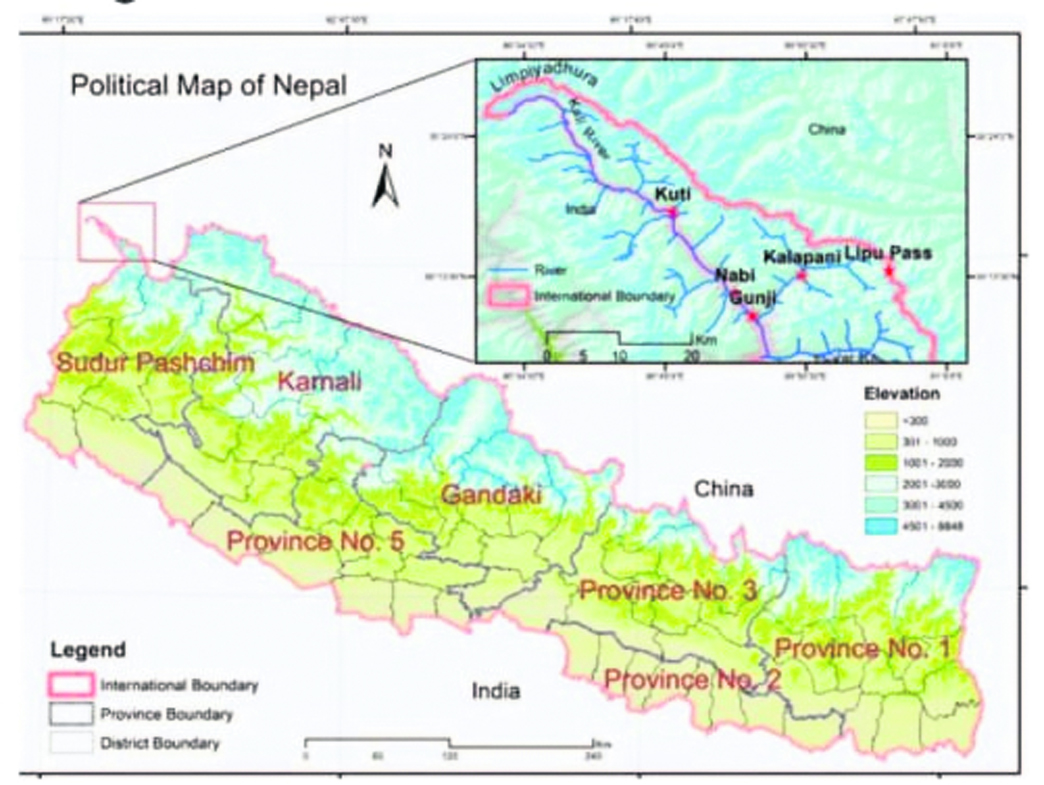
India calls Nepal's new map unjustified
After Nepal came up with a new politicla map showing Lipulekh, Limpiyadhura and Kalapani as its territory, India bluntly asked Nepal not to resort to any 'artificial enlargement' of its territorial claim.
The Ministry of External Affairs said the revised map of Nepal included parts of the Indian territory and asked Kathmandu to refrain from such 'unjustified cartographic assertion'.
India's angry reaction came hours after the Nepal government released a revised political and administrative map of the country laying claim over the strategically key areas along the border between the two countries.
'This unilateral act is not based on historical facts and evidence. It is contrary to the bilateral understanding to resolve the outstanding boundary issues through diplomatic dialogue. Such artificial enlargement of territorial claims will not be accepted by India,' MEA Spokesperson Anurag Srivastava said.
He said Nepal is well aware of India's consistent position on the matter. 'We urge the government of Nepal to refrain from such unjustified cartographic assertion and respect India's sovereignty and territorial integrity. We hope that the Nepalese leadership will create a positive atmosphere for diplomatic dialogue to resolve the outstanding boundary issues,' he said.
The new map was released by Nepal's Land Reforms Minister Padma Aryal during a televised press conference in Kathmandu. The ties between the two countries came under strain after Defence Minister Rajnath Singh inaugurated a 80-KM-long strategically crucial road connecting the Lipulekh pass with Dharchula in Uttarakhand on May 8.
Nepal reacted sharply to the inauguration of the road claiming that it passed through Nepalese territory. India rejected the claim asserting that the road lies completely within its territory. Nepalese Foreign Minister Pradeep Kumar Gyawali last week summoned Indian Ambassador Vinay Mohan Kwatra and handed over a diplomatic note to protest against India inaugurating the key road.
In the midst of the row, Indian Army chief Gen Naravane said there were reasons to believe that Nepal objected to the road at the behest of 'someone else', in an apparent reference to a possible role by China on the matter. The Lipulekh pass is a far western point near Kalapani, a disputed border area between Nepal and India. Both India and Nepal claim Kalapani as an integral part of their territory - India as part of Uttarakhand's Pithoragarh district and Nepal as part of Dharchula district.
Nepalese Prime Minister K P Sharma Oli earlier asserted that Lipulekh, Kalapani and Limpiyadhura belong to Nepal and vowed to 'reclaim' them from India through political and diplomatic efforts.
Addressing Parliament, Oli said the territories belong to Nepal but India has made it a disputed area by keeping its Army there. The ties between India and Nepal came under strain after New Delhi issued a new political map incorporating Kalapani and Lipulekh as part of its territory in October last year.